Download 3D cartography of cities and territories
There are good cartography programs that work with GIS (Geographic Information System) data where you can extract maps with contour lines in 2D and 3D topography of any place.
However, they are not always easy to use or fast… Do you want to get 3D cartography of cities and territories in a few clicks? The solution is called TodoExport and allows you to extract detailed topographic data in various formats.

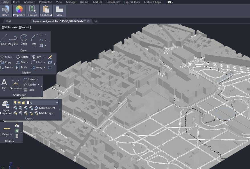
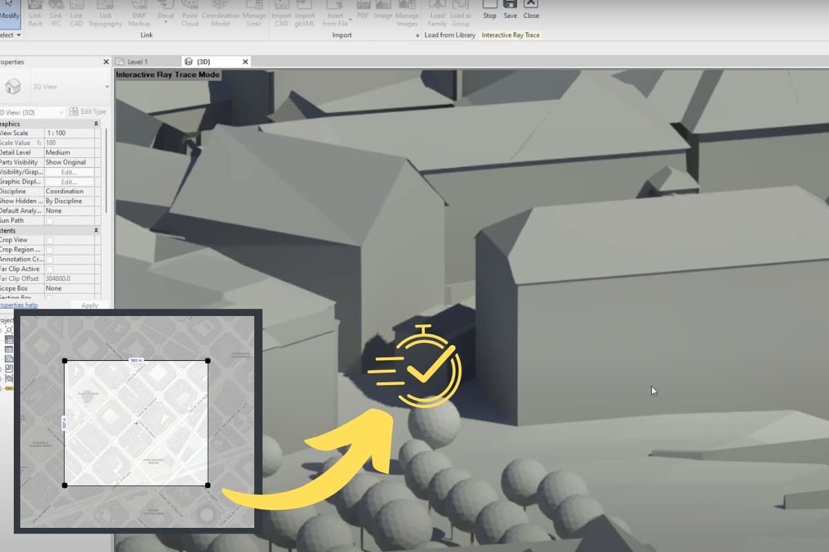
The TodoExport tool automates GIS synthesis by creating digital twins of cities and territories to work in BIM applications (Revit), Archicad, CAD, Rhino, etc.
It is a simple, fast, and accurate web application to download maps with contour lines in 2D and topography in 3D using reliable datasets from OpenStreetMap, Ensemble Digital Terrain Model (EDTM), etc.
The software addresses a specific need for architects, landscapers, urban planners, geographers, etc., providing support maps for architectural projects and spatial analysis of the territory.
For those users who often work with various 3D cartographies of cities, it is an excellent and fast solution!
The downloadable models are fully compatible with BIM tools and support DXF, OBJ, and IFC formats to meet the needs of industry professionals. The application offers three categories of datasets for the selected area:
- High-definition satellite raster image;
- 2D vector cadastral plan with contour lines;
- 3D topographic relief and 3D buildings.
The available export formats are DXF, PDF, SVG, STL, OBJ, and IFC, which adapt to the specific needs of most applications intended for the field of architecture or urban planning.
In three simple steps you get the cartography:
- 1.- Access: Enter the application from TodoExport HERE.
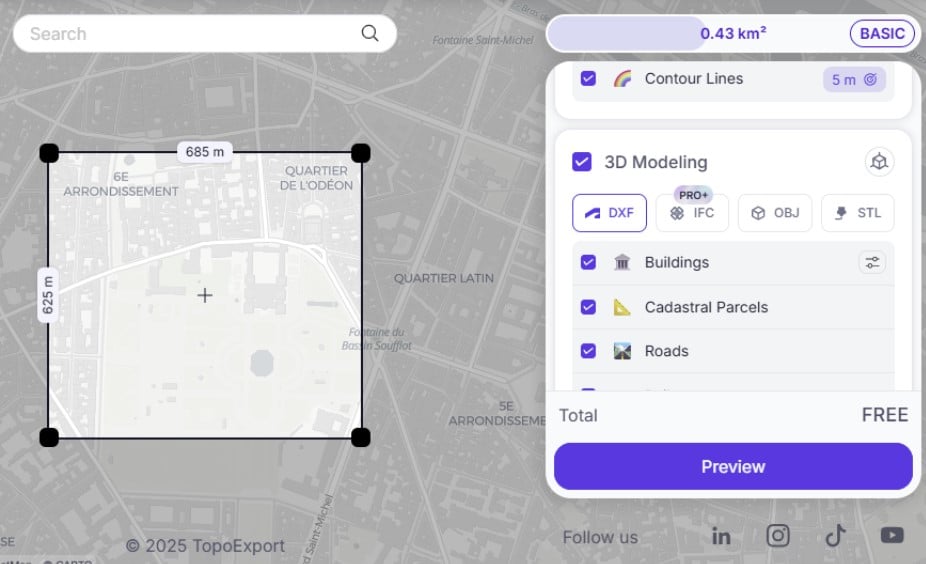
- 2.- Locate location: We select on the interactive map the area we want to download the cartography.

- 3.- Cartographic parameter configuration: We adjust the configuration according to our needs; 2D, 3D cartography, type of file to download, elements that will appear in the cartography, etc.
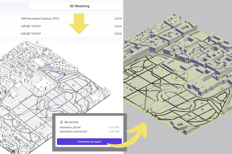
- 3.- Preview and download: once the parameters are configured, we access the 2D and 3D preview, and simply proceed to download.

? Note: It should be noted that the export with the free version is in basic mode. By the way, with Google’s incognito browser, file export gives an error.
The cartographic tool has a free version that allows access to topographic data with certain limitations in terms of resolution and export formats; two exports per day, area up to 1 km, and with 5m accuracy.
In the pro version, cartographic capabilities are expanded covering an area up to 10 km², 0.1m accuracy, georeferenced model, including trees, green spaces, building shadows, etc.
The software is similar to Cad Mapper, but with more options and without the restrictions of only being able to use it in certain cities. You can also check the tools to create custom maps.
If you liked the article, share it!
